The Idaho backcountry is an intimidating place, and rightly so. Many of the destinations there are unforgiving airports with little to no margin for error. The reward for developing the needed skills to fly here is operating in one of the most scenic and remote areas in the continental US. The most challenging strips are generally not accessible to those without a STOL plane and a good amount of experience, but for pilots looking to dip their toe into the backcountry, there are some options that are accessible to your run of the mill GA plane in addition to a reasonable amount of mountain flying training.
The airports listed here (in no particular order) are some of the more accessible airports in the Idaho backcountry. This means those with longer runways and more forgiving approaches that you don’t need tundra tires and a 500ft takeoff roll to land at. All while still being some incredible destinations that makes flying GA worth it.
First though, a word of caution: Backcountry flying is dangerous and without mountain flying instruction you don’t know what you don’t know. Before attempting to land at any of these airports it’s critical that you know your performance numbers, the weather, your approach, your go-around procedure, and everything/anything else you need for operating in the backcountry (which you got formal instruction for, right?). There is no guarantee that you can safely land/takeoff from the airports listed here, that is for you to do more research on and ultimately determine.
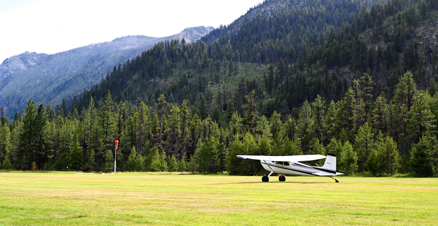
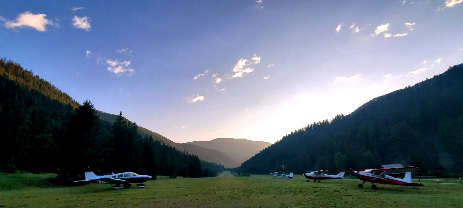
1. 1U1 - Moose Creek
- Elevation: 2,454ft
- Runway length: 4,100ft
At the top of the list is one of the most remote destinations in the Idaho backcountry. Located next to the Selway river, Moose Creek is a destination to behold. The ranger station there was first established in 1921 with the first runway built in 1931. The second, longer runway was finished in 1958.1
Today, Moose Creek serves as an excellent camping location. The appeal to Moose Creek is just how remote it is with the nearest road 25 miles away. If you can, visiting on a clear night with a new moon provides some of the least light polluted skies in the continental US.
In addition to camping, being located at the intersection of its namesake, Moose Creek, and the Selway River creates fishing opportunities. Two suspension bridges provide easy crossing of each river. Or if you enjoy hiking, just to the northwest of the field is the trail to the Shissler Peak fire lookout, although with 3,200 vertical feet to the summit.
What makes Moose Creek accessible is its long runway and lower elevation. At only 2,454ft density altitude is less of a problem. But the lower elevation also means marginally warmer temperatures too. The long runway gives departing planes plenty of length to clear the trees at the end, but do mind the terrain around the airport; depending on where and how you land, a go-around may not be possible.
For more info and a detailed map of the airport see Moose Creek on Pirep.
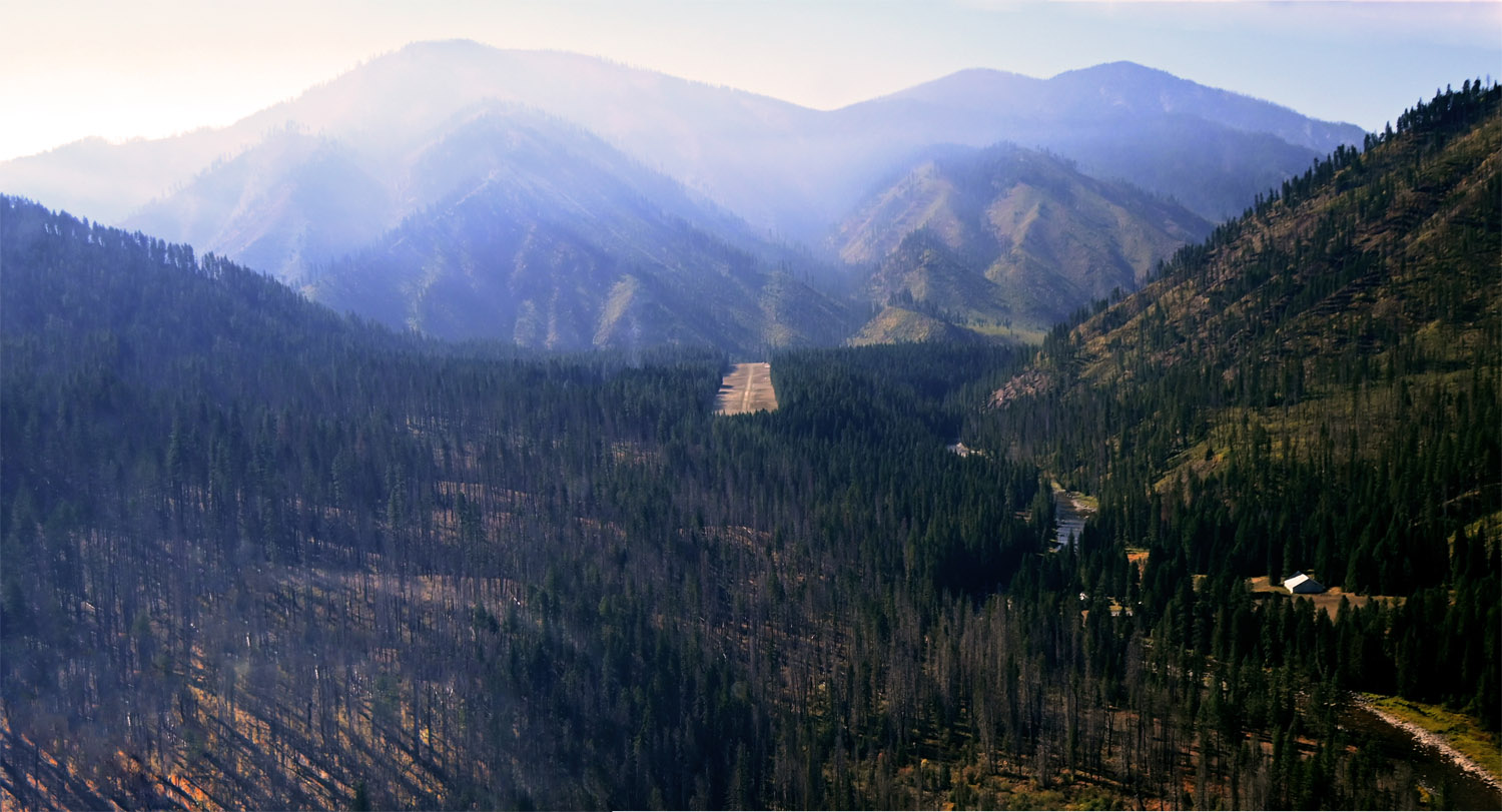
2. 3U2 - Johnson Creek
- Elevation: 4,960ft
- Runway length: 3,400ft
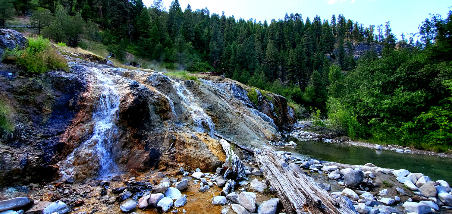
Johnson Creek is Idaho’s premier backcountry airport. The runway itself is beautifully maintained and the camping facilities are second to no other backcountry airport. If you’re looking for a camping location with all of the amenities, this is it. There are numerous campsites, firepits with firewood available, showers, fresh water, even WiFi access and a refrigerator.
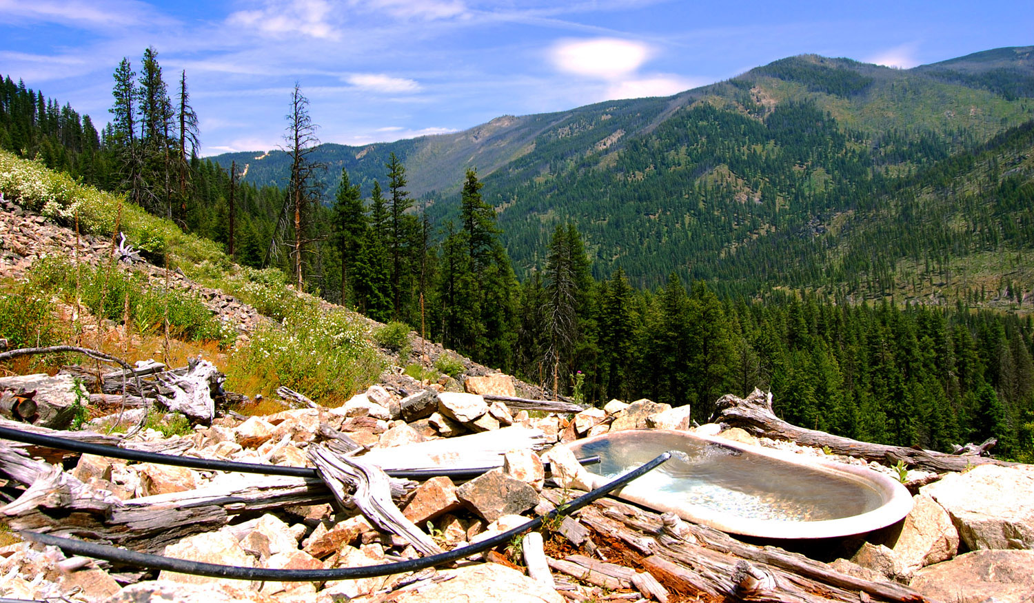
Up the road from Johnson Creek is the town on Yellow Pine with a few food options. One extremely unique part of Johnson Creek is the bathtub hot springs. A short hike from the airport with 400 vertical feet will take you to the hot springs pictured above, complete with an actual bathtub to lounge in while taking in the views of the surrounding mountains.
Johnson Creek is at a decently high elevation of just under 5,000ft often creating density altitude problems. But the long runway makes it accessible to many planes, especially when planning to depart early morning. The valley itself is fairly narrow so knowing your approach is critical. Likewise, traffic here in the summer can be busy at times.
If you visit please consider leaving some money in the donations box to help maintain Johnson Creek.
For more info and a detailed map of the airport see Johnson Creek on Pirep.
3. S81 - Indian Creek
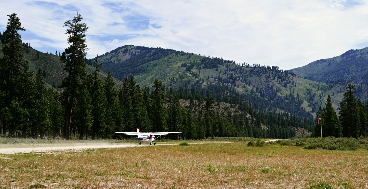
- Elevation: 4,718ft
- Runway length: 4,650ft
Indian Creek is only 20 miles from Johnson Creek, but it is a true backcountry airport. Located inside the Frank Church - River of No Return Wilderness area, there are accordingly no roads that can take you here.
Indian Creek is a good location for those looking to dip their toes into backcountry flying. The runway is exceptionally long and the approach relatively forgiving. This, plus its location along the Middle Fork Salmon River makes it a popular area for rafters to start their trips from. Aside from rafter drop-offs, it’s generally a fairly quiet airport.
For activities there are numerous hiking trails from the airport. You can hike upsteam to the private Pistol Creek Ranch or downstream along the Middle Fork until you feel like turning back around. Given the remote location you’ll likely feel as if you have a mountain range entirely to yourself.
For more info and a detailed map of the airport see Indian Creek on Pirep.
4. U60 - Big Creek
- Elevation: 5,743ft
- Runway length: 3,550ft
At a little under 6,000ft, Big Creek is starting to push it for an “accessible” backcountry airport, but the long and downsloped runway makes it possible to still depart first thing in the morning for most planes with a comfortable margin.
Big Creek is home to the Big Creek Lodge. The original lodge was built in 1934 and burned down in 2008. The Idaho Aviation Foundation raised funds to construct a new lodge which opened in 2018. It now again provides breakfast for pilots flying in or lodging for those that are looking to stay overnight. Dinner/lunch is available too with advanced reservations. If not staying in the lodge, a campsite next to the runway is an option too for a nominal fee.
For more info and a detailed map of the airport see Big Creek on Pirep.
5. 0U1 - Warm Springs
- Elevation: 4,831ft
- Runway length: 2,850ft
Warm Springs is a somewhat unconventional choice for this list. At first glance, the 2,850ft runway and nearly 5,000ft field elevation makes it seem less accessible than it actually is. When taking off to the southwest there are no obstacles and the ground quickly slopes downward. This makes operations considerably easier than needing to climb to clear tall trees.
Otherwise, Warm Springs is a fairly quiet airport. Despite being located off of Route 21, making it not a true “backcountry” airport, it is a good option for those seeking out a quiet place to camp. The main attraction, however, is the hot springs located a short walk down the hill from the runway. The name “Warm Springs” is a bit of a misnomer as the water is near boiling. However, it feeds directly in the Warm Springs Creek where various pools have been constructed of varying water temperatures as the hot and cold water mix allowing you to find the right temperature.
For more info and a detailed map of the airport see Warm Springs on Pirep.
Bonus Airport: 8U2 - Schafer Meadows
- Elevation: 4,856ft
- Runway length: 3,200ft
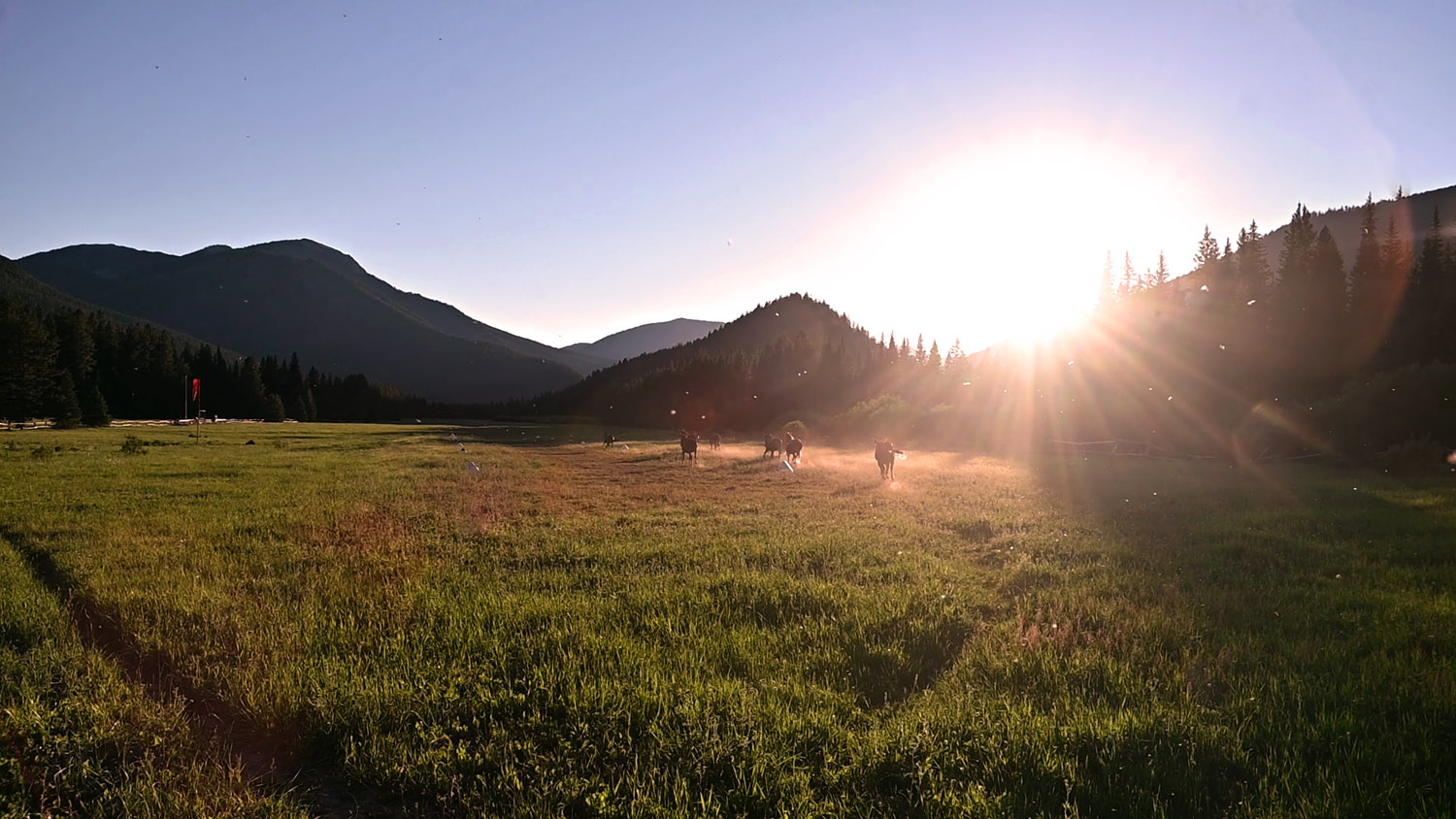
Finally, as a bonus option to consider, Schafer Meadows is in Montana, but well worth the visit. Located deep within the Bob Marshall wilderness, Schafer Meadows is a remote backcountry airport. It’s arguably the least “accessible” airport on this list due to its high elevation and semi-short runway with tall trees on both ends.
However, Schafer Meadows is a excellent camping location. The airport campground is located in the trees just to the east of the runway. The ranger station with its herd of horses is worth a walk through as well. River access is available too by following the trail to the east from the campground.
Schafer Meadows receives a good amount of traffic as the start location of many rafting trips on the Middle Fork Flathead river. Come prepared for bugs in the summer too.
For more info and a detailed map of the airport see Schafer Meadows on Pirep.
Shameless Plug
The information on this page came from Pirep.io, a collaborative database of all public, private, and unmapped airports in the US that all pilots can contribute to, no registration required. Do you have information about other airports in Idaho? Or even just local knowledge on your home field? If so, you can help out other pilots learn of new places to fly by taking a few minutes to document it on Pirep.
Sources
-
Bound for the Backcountry, Richard H. Holm Jr., p405 ↩